Whitewater River
California
The Whitewater River originates high on the 11,499-foot Mount San Gorgonio in the San Gorgonio Wilderness and includes the North, Middle, and South Forks. From the headwaters, the designated reach flows through the San Bernardino Mountains for 28 miles to the Coachella Valley area. This river is jointly managed by Bureau of Land Management and U.S. Forest Service.
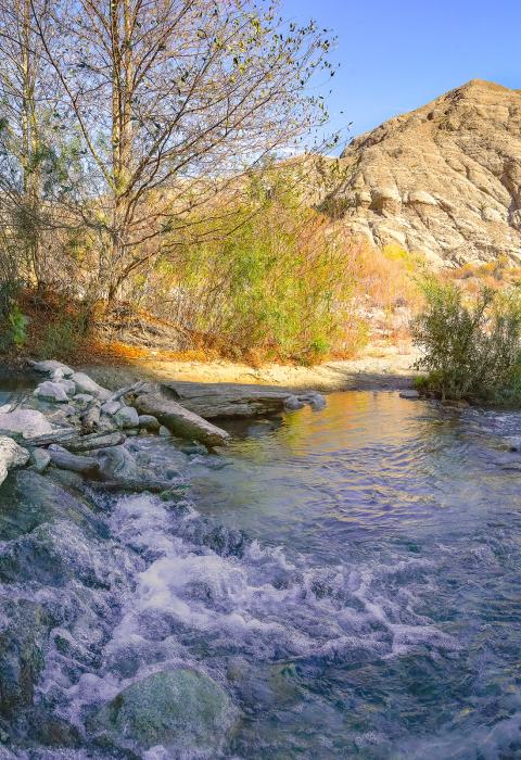
The river corridor includes highly diverse, colorful, and striking scenery, with regionally unique headwater springs and steep, textured canyon walls. Wildlife viewing opportunities are also outstanding as the river corridor provides a critical link between the San Bernardino and San Jacinto Mountains, supporting a large amount of quality remote, pristine, and diverse habitat for Nelson's bighorn sheep, California spotted owl, mule deer, black bear, and arroyo toad. The riparian habitat seasonally hosts endangered neo-tropical songbirds, including the least Bell's vireo and southwest willow flycatcher. The Whitewater River is also an important ceremonial and cultural area for traditional Cahuilla Indians, who visit the river to collect and gather native materials.
Designated Reach
March 12, 2019. The Middle Fork of the Whitewater River from its source to the confluence with the South Fork. The North Fork of the Whitewater River from its source near Mt. San Gorgonio to the confluence with the Middle Fork. The South Fork of the Whitewater River from the confluence with the East Fork to the confluence with the Middle Fork. The main stem of the Whitewater River from the confluence of the South and Middle Forks to 0.25 miles upstream of the southern boundary of Section 35, T 2 S, R 3 E, San Bernardino Meridian.
Outstandingly Remarkable Values
Culture
The canyon, home territory of the Wanakik lineage of Cahuilla Indians, is considered to be an important collecting and gathering area and contains ceremonial sites and Native American sensitive areas.
Recreation
The river transitions from the developed, desert valley to the remote, forested reaches of the San Gorgonio Wilderness. The river offers numerous opportunities for primitive recreation, including hiking, backpacking, equestrian use, hunting, and bird watching. The river can be accessed by the Pacific Crest Trail and other trails accessing the canyons.
Wildlife
The canyon provides outstanding habitat for the state and federally listed endangered southwestern willow flycatcher, arroyo southwestern toad, least Bell’s vireo, as well as the summer tanager, yellow warbler, yellow-breasted chat, gray vireo, and Crissal thrasher.

