Buffalo River
Arkansas
The Buffalo River is in northwestern Arkansas. This segment of the river flows from its headwaters through the Upper Buffalo Wilderness to the boundary of the Ozark National Forest. From the National Forest boundary, 135 miles of the river, to its confluence with White River, was designated as the Buffalo National River in 1972 and is managed as a unit of the National Park Service.
Recreational opportunities include camping, hiking, and fishing, with most of this use occurring in the Upper Buffalo Wilderness. Experienced whitewater boaters float the wild segment immediately following rainstorms, with river difficulty rated Class III-IV and an average gradient drop of 38 feet per mile.
A variety of animal life is found within the corridor. Mammals, such as canyon bats, gray squirrels, raccoons, white-tailed deer, wood rats, and black bear, occur. Neotropical migrant birds, such as the ovenbird, wood thrush, and red-eyed vireo, are well represented, along with species like the Louisiana waterthrush and parula warblers, which favor riparian habitat. In the corridor, where mixed herbaceous plants and shrubs are found, species such as the yellow-breasted chat, yellowthroat, and summer tanager may be found.
The Buffalo River is managed for smallmouth bass with special length and creel limits. The upper reaches of the river differ in character from downstream reaches where the river widens and supports larger fishable pools.
Designated Reach
April 22, 1992. From its origin to the Ozark National Forest boundary.
Outstandingly Remarkable Values
Culture
There are more than 18 prehistoric and historic sites that have been documented in the Upper Buffalo Wilderness, with at least 7 of those documented within the river corridor. Most of these sites are either prehistoric bluff shelters or of old house-places (rock walls, linear rock piles, chimney falls) showing evidence of past living patterns.
Geology
The geology of the Buffalo River watershed is comprised of sandstones and shale at higher elevations in the Boston Mountains Plateau, and sandstone, limestone, and dolomites at intermediate and lower elevations of the Springfield and Salem Plateaus. The headwaters of the river lie within the eastern portion of the Boston Mountains and consist of a flat and gently rounded plateau and high-walled drainages with steep slopes and sheer rock walls. The scenic segment is dominantly within the Atoka Formation, which is shale with subordinate amounts of sandstone and silt. Also present with greater dominance downstream is Bloyd Shale, which is composed of shale, sandstone, and limestone. Further downstream in the wild segment, Pitkin, Fayetteville, and Batesville Formations are predominantly limestone with some shale evident. Also within the area is the Hale Formation, which is shale, sandstone, and limy sandstone. The Boone Formation near the northern boundary of the Upper Buffalo Wilderness is composed of limestone and chert.
Other
Air Quality: This wilderness is the only wilderness within the Ozark National Forest which is designated as a Class I Air Quality Area. The three air-quality-related values identified for the area are water quality, visibility, and vegetation diversity.
Scenery
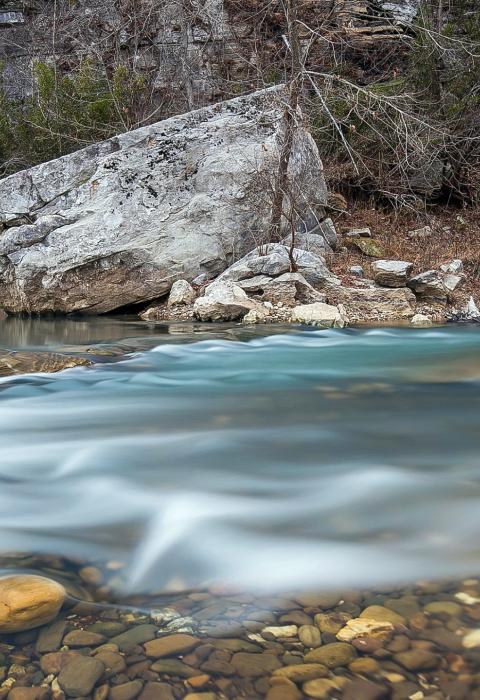
The upper river (the portion designated as a component of the National Wild and Scenic Rivers System) offers outstanding scenery. This approximate 16-mile segment is characterized by highly varied and rough terrain with uneven, sheer sharp ridges and/or cliffs, large unusual rock outcrops or formations, and steep slopes. The stream is clear and exhibits rapids and still pools with reflecting qualities.

