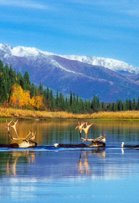
Kobuk River
Alaska
The 380-mile-long Kobuk River originates in the Endicott Mountains in the Brooks Range and flows west to Kotzebue Sound. The river’s wide valley, exceptional rapids, and outstanding biota provide remarkable natural resources. The river passes through two scenic canyons. In the upper canyon, you'll encounter some Class IV rapids that need to be portaged (about 1/3-mile portage), and there is one section of Class II-III rapids in the lower canyon.
Designated Reach
December 2, 1980. The segment within Gates of the Arctic National Park.
Outstandingly Remarkable Values
Culture
The Kobuk River contains an exceptionally rich record of past human activity that spans at least 10,000 years. Within Gates of the Arctic, the river corridor contains at least 172 historic and prehistoric archeological sites that represent Paleoarctic, Northern Archaic, Arctic Small Tool, Late Prehistoric, and Historic Periods. Site types include villages, camps, hunting overlooks, portages, and resource extraction locations. The valley was a major east-west travel corridor connecting coastal areas around the Bering Strait to northern interior Alaska. These interactions are demonstrated by the frequent occurrence of obsidian, jade, and other exotic raw materials in ethnographic accounts and archeological sites on the Kobuk River. The river was a particularly important path of distribution for obsidian derived from a major source on the Koyukuk River some 150 miles to the southwest and is the only known source of jade in mainland Alaska.
Fish
The Kobuk River is one of only two major spawning grounds for the Kobuk/ Selawik population of sheefish. The Kobuk is inhabited by relatively large sheefish, with individuals exceeding 40 pounds. Many other fish species also inhabit the Kobuk, including grayling, arctic char, whitefish, chum salmon, and lake trout. The Kobuk is a major chum salmon spawning ground, believed to support more than half of the Kotzebue District’s commercial chum salmon. Additionally, the Kobuk provides several Eskimo villages with subsistence fishing for sheefish, whitefish, and chum salmon, which spawn in the upper portion of the river.
Geology
The Upper and Lower Kobuk Canyons, as well as the Endicott Mountains, are unique geologic features characterizing the Kobuk River region. Within the Lower Kobuk Canyon, bedrock covers the canyon floor with nearly vertical sheets of shale along the banks. Quartz and jasper or jade, in conjunction with shale, are also viewable.
Recreation
The Kobuk is highly desirable among anglers for its sheefish fishery, particularly for its trophy sheefish, and accounts for more than half of northwestern Alaska’s sport sheefish harvest. Additionally, chum salmon, arctic grayling, and whitefish can be caught along portions of the Kobuk River. The Kobuk River provides exceptional opportunities for novice and experienced rafters alike. The highly variable surroundings of the remainder of the Kobuk corridor provide an interesting and ever-changing float experience as the river flows from Walker Lake and the Arctic mountains to lowland boreal forest. The river provides a range of unique conditions along 125 miles of floatable river, including Class I to Class V rapids.
Scenery
The Kobuk River has a diverse range of scenery, from the dramatic headwaters at Walker Lake to the interior lowlands. Walker Lake, part of the headwaters of the Kobuk, is the largest lake in the Brooks Range and is a national natural landmark. It is a glacially carved lake that is surrounded by the dramatic topography for which the central Brooks Range is famous. Two canyons, the Upper Kobuk and the Lower Kobuk, provide visitors with unique scenic opportunities. Bluffs 100 to 200 feet tall exemplify the Upper Kobuk Canyon, while the Lower Kobuk Canyon is punctuated by large sandstone boulders and narrow canyon walls.

