John River
Alaska
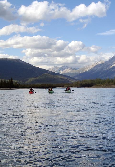
The John River flows 136 miles from the 6,000-foot-high Endicott Mountains to its confluence with the Koyukuk River. From its origin at Soakpak Mountain, the John River flows through Anaktuvuk Pass and then south through the Brooks Range's alpine tundra and forested valleys to the Koyukuk River just below Bettles Field/Evansville. The river’s notably low valley and narrow corridor contribute to its unique character, through beautiful areas and a variety of ecosystems. The upper portions of the river provide a Class II to Class III+ float when water is high enough. The lower reaches make an excellent family float. There is excellent hiking and backpacking in upper river area, though initially the river runs through Nunamiut Corporation land.
Designated Reach
December 2, 1980. The segment within Gates of the Arctic National Park.
Outstandingly Remarkable Values
Prehistory
Due in part to its role as a major route for caribou migration, the John River has long been an important focus of human activity, as demonstrated by a dense accumulation of regionally and nationally significant archeological sites and cultural properties. The valley straddles both Inupiat and Athapaskan cultural spheres; as such, it has high value for anthropological and archeological studies of prehistoric cultural relations. Sites in and around Anaktuvuk Pass at the head of the John River Valley represent an internationally significant archeological district that contains a long and continuous record of human habitation spanning at least 8,000 years and includes several key type sites for archeological cultures that have been defined for northern Alaska.
Scenery
Features, such as high relief, remarkable plant diversity, exposed rocks, cliffs, and rock outcroppings, provide desirable and unique scenic qualities along the John River. Additionally, diverse ecosystems provide the user with ever-changing surroundings. Proximity from the river to adjacent mountains and the notably low valley provide outstanding views within the middle and upper portions of the river.
Between the Hunt Fork of the John River and the mainstem of the John River, a distinct mountain provides outstanding views of Gray Mountain, Boreal Mountain, and many other peaks that characterize the Brooks Range. The John River drainage is uniquely narrow, about one mile wide, with mountain slopes directly bordering the corridor.
Wildlife
Anaktuvuk Pass, part of the John River Valley, is a primary migration route for three herds of caribou—the western Arctic, Central Arctic, and Teshekpuk herds. While many rivers in this region serve as migration corridors for one or more caribou herds, the unique qualities of the John and its valley make it a particularly attractive route for an unusual number of herds.

