Chilikadrotna River
Alaska
The Chilikadrotna River originates from the Chigmit Mountains (a sub-range of the Alaska and Aleutian Ranges) at Twin Lakes, flows west through its foothills approximately nine miles to the border of Lake Clark National Park and Preserve, and then re-enters the Preserve for 2.6 miles. The river continues an additional 35 miles through state land before joining the Mulchatna River.
Designated Reach
December 2, 1980. The portion of the river within Lake Clark National Park and Preserve.
Outstandingly Remarkable Values
Fish
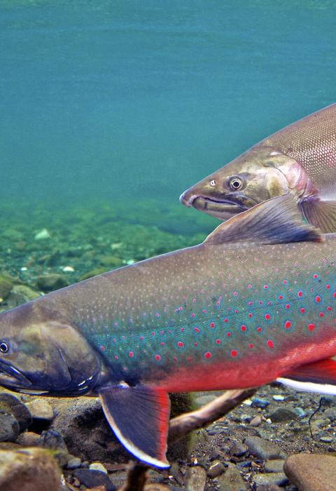
There are several known fish species in the Chilikadrotna, including rainbow trout, Arctic grayling, Dolly Varden, and four species of salmon (Chinook, coho, sockeye, and chum). Although fish densities are similar to other alpine clearwater rivers in western Alaska, fishing on the Chilikadrotna is well regarded and the upper reaches of the river provide excellent rearing and spawning habitat to support its various fisheries.
History
During the late pre-historic and historic period, the important Dena’ina Telaquana Trail connected Kijik Village on Lake Clark with other villages in the Nushagak and Kuskokwim drainages. The Telaquana Trail crosses both the upper Chilikadrotna and upper Mulchatna Rivers at traditional fords, which remain crossable even during higher summer flows.
The upper Chilikadrotna and Mulchatna River corridors were also traditional caribou and Dall’s sheep hunting grounds of the Lake Clark Dena’ina. There are several Dena’ina place names documented on both upper rivers, affirming Dena’ina hegemony in the area. Russian fur trading in the late 1700s and 1800s further confirms Dena’ina use of the Mulchatna basin.
Recreation
The Chilikadrotna offers exceptional recreational opportunities, including floating, fishing, camping, wildlife viewing, hiking, berry picking, hunting, trapping, and photography. Most float the river for five to seven days, well past the confluence with the Mulchatna; however, longer trips are possible, including a trip to Dillingham on Bristol Bay via the Mulchatna and Nushagak Rivers that would take several weeks.
For most of the designated reach, the river is a fast-flowing Class I-II single-thread channel boatable in a canoe, kayak, raft, or pack raft. A few riffles may offer Class II/III challenges, and boaters must possess sufficient skill to avoid occasional sweepers or tight turns, but the river is generally free of major log jams or portages. There is also a 3.5-mile reach with slower water.
Scenery
Within the park boundary, the Chilikadrotna flows through eligible wilderness, and the entire river has exceptional wilderness character. The corridor has few traces of human use or habitation, and natural geologic, hydrologic, and biologic processes are free from on-site modern human influence. The headwaters of the river exist in a primitive and natural state.
Scenery along the Chilikadrotna River is exceptional, particularly near its Twin Lakes headwaters. Upper Twin Lake (six miles long) settles glacial sediments to provide crystal clear water in Lower Twin Lake (four miles long), which reflects alpine tundra and snow-covered peaks that rise up to 3,700 feet above the lake’s 2,000-foot elevation.

