Nashua, Squannacook & Nissitissit Rivers
Massachusetts, New Hampshire
Located in north-central Massachusetts and southeastern New Hampshire, the Nashua River watershed covers 538 square miles, includes 32 communities, and supplies drinking water to over two million people. It is highly forested, abundant in water resources and open spaces, with thousands of acres of lands protected. According to the Nashua River Watershed Association, the lands are comprised of approximately 62% forested land, 13% residential lands, and 12% agricultural lands. The watershed area within Massachusetts is still rather rural but is under constant threat of development due to its proximity to the greater Boston area. Some towns within the region have seen significant growth, resulting in a loss of open space. The Nashua River and its major tributaries, the Squannacook and Nissitissit Rivers, boast outstanding natural, recreational, scenic, historic, and cultural resources.
Designated Reach
March 12, 2019. The mainstem of the Nashua River from the confluence of the North and South Nashua Rivers in Lancaster, Massachusetts, and extending north to the Massachusetts-New Hampshire border, excluding:
- From 700 feet upstream of the crest of Ice House Hydroelectric Project Dam to 500 feet downstream.
- From 9,240 feet upstream from the crest of the Pepperell Hydroelectric Project Dam to 1,000 feet downstream.
The Squannacook River from its headwaters in Ash Swamp, Townsend, Massachusetts, extending downstream to the confluence of the river with the Nashua River in Shirley/Ayer, Massachusetts, excluding from 1,200 feet upstream of the crest of the Hollingsworth and Vose Dam to 2,665 feet downstream.
The Nissitissit River from its headwaters in Brookline, New Hampshire, to the confluence of the river with the Nashua River in Pepperell, Massachusetts.
Outstandingly Remarkable Values
Culture
The rivers’ abundant food sources and their usefulness for travel made them important to Native Americans, whose presence has been documented by numerous investigations of streamside archaeological sites. Due to the presence of prime agricultural soils in the large floodplains along the banks of the river, there is a long-term agricultural history. Agrarian history dates back to the prehistoric Late Woodland Period. Native Americans burned the land to keep it open, which made it attractive to European settlers who arrived in the 17th century.
The history and revitalization of the Nashua River has received national and international acclaim. Industrial development in the cities along the river came at a price; by the 1960s the Nashua River was one of the ten most polluted rivers in the country. However, thanks to the tireless work of Marion Stoddart and other concerned citizens, the revitalization of the Nashua River was made possible.
Ecology
Biological and ecological diversity in the area can be measured by the sheer number of species and by the number of species assemblages (natural communities of plant and animal species that share a common environment and occur together repeatedly on the landscape). Abundant wetlands, grasslands, and uplands shelter many rare species, most of which need more than one habitat to survive or depend upon increasingly rare habitats.
Fish
The Nashua River, which is heavily used by recreational anglers, supports a substantial warmwater fishery, including largemouth bass, chain pickerel, brown trout, fallfish, carp, blacknose dace, black crappie, common and golden shiner, brown bullhead, tesselated darter, yellow and white perch, white sucker, slimy sculpin, and bluegill. The burgeoning fish population in the mainstem Nashua River is sustained by all the surrounding open water wetlands.
Recreation
High-quality water supports water-based recreation as well as the enjoyment of numerous greenway trails by the banks. The Nashua River, for the most part, flows relatively slowly, and so is generally appropriate for boaters, including beginners. The Nissitissit and Squannacook Rivers are widely regarded as providing some of the best fly-fishing within reach of Boston, Nashua, and Worcester area anglers and have been for a long time.
Scenery
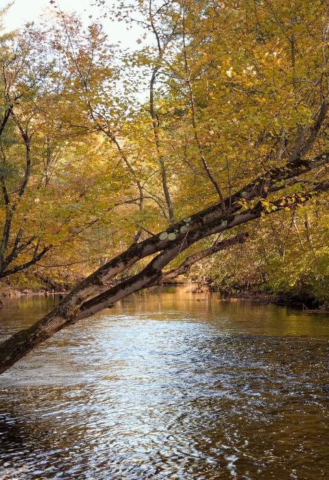
The rivers’ shorelines are remarkably undeveloped, and their scenery is exquisite. One of the most famous views in central Massachusetts is of the Nashua River valley from Prospect Hill at Fruitlands Museum—it looks much as it might have a century ago—and is listed in the 1982 Massachusetts Scenic Landscape Inventory. The Nashua, Squannacook, and Nissitissit Rivers abound with scenic vistas, both from the rivers toward the shores and of the rivers from the land.
Wildlife
The Nashua River corridor provides breeding and migration habitat for listed bird species, such as king rail, pied-billed grebe, and common moorhen. It provides potential habitat for American and least bitterns, as well as the blue spotted salamander and the water shrew, both of which are dependent on the interspersion of wetland and terrestrial habitats. The Nashua watershed is home to the largest known population of state-listed Blanding’s turtle and possibly the largest in New England. The Nissitissit River is also home to five species of freshwater mussel.

