Missisquoi & Trout Rivers
Vermont
The Missisquoi River and Trout Rivers and their tributaries provide countless resources to the communities through which they run including cultural, scenic, recreational, and water resource values. These rivers support a diverse fishery resource, with a mix of high-elevation cold-water streams, as well as slower‐flowing warm water reaches. The river and its many tributaries are also popular for boating, swimming, and wildlife viewing. These rivers also provide an important water resource for human use including drinking water and agricultural needs.
Designated Reach
December 19, 2014. The Missisquoi River from the Lowell/Westfield town line to the Canadian border in North Troy, excluding the property and project boundary of the Troy and North Troy hydroelectric facilities. The Missisquoi River from the Canadian border in Richford to the upstream project boundary of the Enosburg Falls hydroelectric facility in Sampsonville. The Trout River from the confluence of the Jay and Wade Brooks in Montgomery to its confluence with the Missisquoi River in East Berkshire.
Outstandingly Remarkable Values
Geology
The Serpentine Outcroppings in the area along the Missisquoi River in Lowell, Troy, and Westfield represent a high concentration of these rocks in Vermont. These outcroppings are part of one of the largest ultramafic serpentine zones in the country. This serpentine belt includes the blueschists (very high pressure metamorphosed volcanic rocks) in the Tillotson Peak area, which are unique in Vermont and the Appalachian Belt. These rocks are described in field guides and attract geologists from all over the world.
History
The rivers are spanned by the greatest concentration of covered bridges of any area in the country. In Montgomery alone, there are six covered bridges still in use today. A seventh, the Hectorville Bridge from Gibou Road, is currently in off-site storage awaiting repair. All were built by the same men, the Jewett brothers, in the 1800s and are listed on the National Register of Historic Places. These historic bridges, along with one in Troy and another in Enosburgh, are popular destinations for sightseers and add to the unique local character of the region.
Recreation
The rivers provide outstanding opportunities for canoeing, kayaking, fishing, hunting, swimming, hiking, and wildlife viewing. The numerous swimming holes within the Missisquoi and Trout Rivers are a popular destination for locals and visitors alike. The countless pools and falls of the Trout River in Montgomery have created many swimming areas in the town. Other popular swimming holes are within the towns of Lowell, Westfield, and Troy.
Canoeing and kayaking opportunities abound along the Missisquoi and Trout Rivers. The rivers offer unique experiences for all levels of paddling, from gentle meandering float trips to technical whitewater runs. There are significant opportunities for sport fishing in the upper Missisquoi and Trout Rivers. The rivers hold quality fish habitat throughout, supporting both warm‐ and cold‐water fisheries.
Scenery
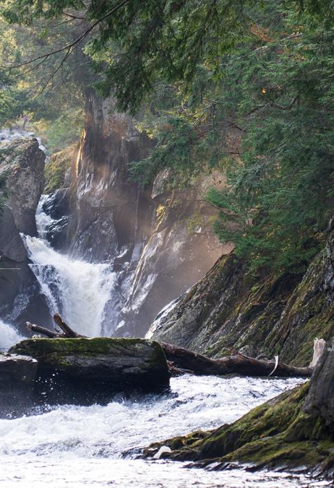
The Missisquoi and Trout Rivers are renowned for their numerous deep, picturesque bedrock swimming holes. Clear waters add to exception scenery. Big Falls is the largest natural, undammed falls in Vermont; it is also a state park. This geologic feature consists of three separate channels with a total vertical drop of about 40 feet (25 feet being the largest single drop). There is a 225-foot-long gorge downstream of the falls with 60-foot-high walls. The gorge ends in a large pool about 100 feet across with beaches that make for good swimming and an excellent place for fall foliage viewing.

