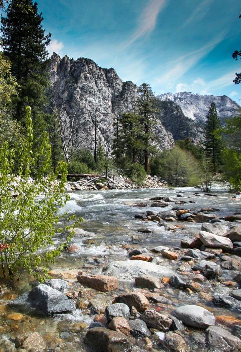
Kings River
California
The Kings River includes the entire Middle and South Forks and six miles of the Kings River. It flows through Kings Canyon National Park and the Sequoia and Sierra National Forests. Beginning in glacial lakes above timberline, the river flows by deep, steep-sided canyons, over falls and cataracts, eventually becoming an outstanding whitewater rafting river in its lower reaches in Sequoia National Forest.
The river traverses through the second deepest canyon in North America and offers tremendous scenery and recreation experiences. The Kings River, along with its forks, is one of the largest rivers flowing down the western slopes of the Sierra and forms the boundary between the Sequoia and Sierra National Forests. Kings Canyon Scenic Byway will take you to the eastern section of the river as it passes through the spectacular Kings Canyon, where you will find wilderness trailheads, Grizzly Falls Picnic Area, Boyden Caverns, and U.S. Forest Service and National Park Service campgrounds near the river.
Designated Reach
November 3, 1987. From the confluence of the Middle Fork and the South Fork to the point at elevation 1,595 feet above mean sea level. The Middle Fork from its headwaters at Lake Helen to its confluence with the main stem. The South Fork from its headwaters at Lake 11599 to its confluence with the main stem.
Outstandingly Remarkable Values
Ecology
The area between Tehipite Valley and Simpson Meadow has remarkable stands of sugar pine. Where the river slows and broadens, it passes through lush meadows. Populations of insectivorous sundews can be found in Big Pete, Grouse, and the unnamed meadows south of Simpson Meadow; these likely represent elevational range extensions for this species. Near Big Pete Meadow, the river is lined by ericaceous vegetation, which is unusually rich in members of the heath family. Mats of blueberry, heather, and Labrador tea emerge from a thick carpet of sphagnum mosses, including a rare species of Helodium unknown elsewhere in California. At least three rare plants occur in the drainage—Muir’s raillardella, Tehipite jewel flower, and Kings Canyon sedge.
Geology
The Kings Canyon is one of the Sierra Nevada’s rare and best examples of a “Yosemite,” a deep canyon with sheer granite cliff faces on either side of the river valley that rivals the true Yosemite. The South Fork flows through spectacular examples of valley glaciation. The Upper Basin contains examples of cirques, arete, and horn development. There are deeply glaciated canyons, including the remote Muro Blanco and the picturesque Paradise Valley. The Middle Fork contains Tehipite Dome, which is one of the premier examples of granitic exfoliation in the United States.
History
Before 1900, Indians, sheepherders, and a few explorers had entered the region. Tehipite Valley contains Indian village sites that include rock paintings of significance. Other Indian sites probably occur but have not been catalogued. Muir Pass, just above the river’s source, has a small stone shelter erected about 1930 and eligible for the National Register of Historic Places.
Recreation
The Middle Fork is paralleled by popular wilderness trails, with the upper end accessible by a segment of the John Muir and Pacific Crest Trails. The South Fork’s upper reaches (Upper Basin) and middle reaches (Paradise Valley) provide exceptional recreation. The exceptional and remote alpine scenery provides a variety of high-quality wilderness recreational opportunities, including hiking, climbing, photography, and experiencing solitude.
Scenery
The upper section of the Middle Fork of the Kings River encompasses continuous vistas of spectacular mountain peaks. The middle section is dominated by very steep, glaciated valley walls. The headwaters of the South Fork provide exemplar scenery of the classic high Sierra, lake-studded alpine basins.
Wildlife
Due to the 6,000-foot change in elevation, native river-dependent wildlife is extremely diverse in the area.

