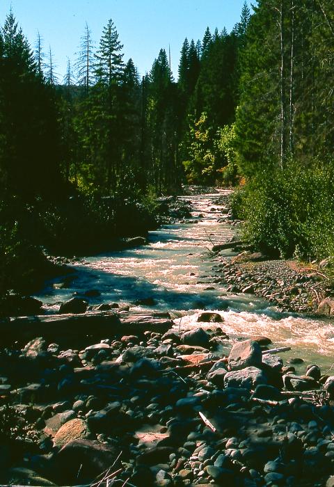
Middle Fork Hood River
Oregon
The Middle Fork Hood River has its origins in several glaciers on the north slope of Mt. Hood in Oregon’s Cascade Range. The Clear Branch, Coe Branch, and Eliot Branch join to form the Middle Fork Hood River near the Parkdale Lava Beds. The river flows in a northerly direction, joins the West and the East Fork and eventually flows into the Columbia River near the town of Hood River, Oregon.
While recreation use in the area is currently limited to dispersed day or overnight use primarily by local users, the area has a high potential for interpreting volcanic processes that could attract users from around the region. The lava flow is easily accessible and is an excellent example of some of the volcanic forces that helped form the Cascade Mountain Range.
Designated Reach
March 30, 2009. From the confluence of Clear and Coe Branches to the north section line of Section 11, Township 1 South, Range 9 East.
Outstandingly Remarkable Values
Fish
This segment of the Middle Fork Hood River provides some high-quality habitat for listed or candidate Pacific Northwest (U.S. Forest Service Region 6) threatened, endangered, and sensitive species. Several salmonid species federally listed as threatened and their critical habitat are present in the Middle Fork of the Hood River, including Columbia River bull trout (Salvelinus confluentus). Bull trout is considered a unique, species because it is the only remaining natural population in the forest, as well as northwest Oregon. Due to its available access, the Middle Fork of the Hood River provides opportunities for aquatic scientific study and/or interpretation. In addition, this segment is considered to play a part in the regional recovery of the federally listed (threatened) lower Columbia River steelhead trout (Oncorhynchus mykiss) and Columbia River bull trout.
Geology
Two major recent geologic processes have shifted the location of this entire segment of the Middle Fork of the Hood River and illustrate the dynamic nature of the landscape in this area. The upper portion of the river has been diverted to the north and west side of the valley by large debris flow fan deposits created by frequent massive debris flows in Coe and Eliot Branch Creeks. This geologic process is still very active. The 7,000-year-old Parkdale Lava Flow filled the pre-existing Middle Fork Valley and diverted the river to the west edge of the old valley.
This basalt lava flow is the youngest lava flow in the Cascades between Mt. Jefferson and Mt. Adams and is unique in that it has a major river flowing along its entire 3.9-mile length. Both of these geologic processes have had, and continue to exert, a major influence and control on the Middle Fork. The relatively accessible and striking physical evidence for both of these geologic processes within such a short segment of the river is a regionally unique combination of geologic and hydrologic features.
Scenery
The views of lava flows and unique rock forms have been found to be visually unique within the region of comparison. The river is bounded on the east side by the Parkdale Lava Beds, an excellent example of an A'a (pronounced "ah ah") type of lava flow which is typified by rough, jagged, and cindery surfaces. High-quality flows of this nature are rare for the region and can be considered a "textbook" example.
The lava flow provides an excellent example of successional stages taking place in the reestablishment of vegetative cover on the lava flow. The southern, or upper, end of the flow already has trees and other vegetation becoming reestablished. The northern, or lower, end of the flow is still virtually barren. The diversity throughout the lava flow provides a unique display of natural processes in action in one location.

