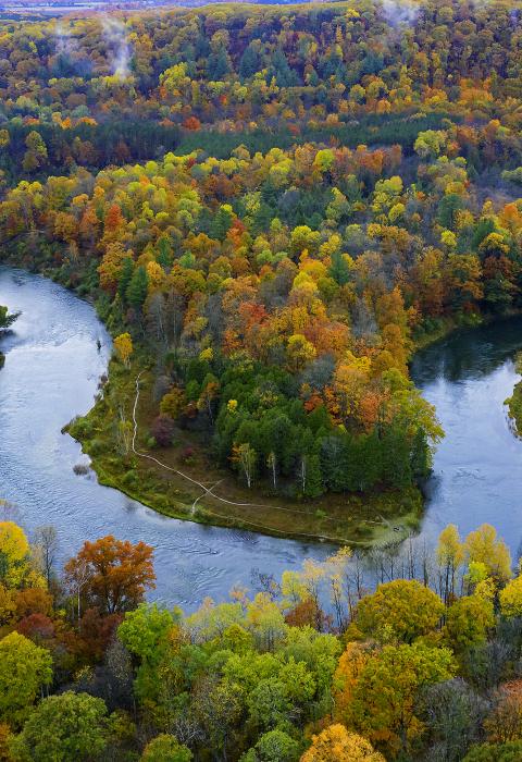
Manistee River
Michigan
The Manistee River is located in the northwest portion of Michigan’s Lower Peninsula and partially within the Manistee National Forest. The name "Manistee" is from an Ojibwe word first applied to the principal river of the county. The derivation is not certain, but it may be from ministigweyaa, "river with islands at its mouth." Other sources claim that it was an Ojibwe term meaning "spirit of the woods." The river is well known for beautiful scenery, excellent fishing, and a variety of recreational activities.
Designated Reach
March 3, 1992. From the Michigan Department of Natural Resources boat ramp below Tippy Dam to the Michigan State Highway 55 Bridge.
Outstandingly Remarkable Values
Fish
The Manistee River supports a superior steelhead, chinook, and coho salmon fishery. These fisheries are based both on natural reproduction and supplemental stocking programs. Very good populations of resident brown trout, smallmouth bass, and walleye are also present. Lake sturgeon and river redhorse utilize the river for spawning. A reduced sand bedload results in increased aquatic invertebrate production and additional gravel spawning areas and pool habitat. Structural cover is also abundant due to the presence of large woody debris.
Recreation
The Manistee River is accessible to several major population centers which contributes to the amount of recreation use it receives; the entire river basin is heavily used for many types of dispersed recreation during the entire year. The river supports a variety of other recreational uses, including wildlife viewing, hiking, canoeing, and hunting. Canoeing on portions of the Manistee and its tributary, the Pine River, is popular during the summer months.
The river is easily accessible by visitors. There are eight developed river access sites within the wild and scenic river corridor. The Forest Service maintains sites at High Bridge, Bear Creek, Rainbow Bend, and Blacksmith Bayou. The state of Michigan operates a river access site at Tippy Dam. Private recreation sites include Big Manistee Riverview Campground and Coho Bend Campground. The U.S. Forest Service developed recreation sites along the Manistee River require a vehicle parking pass under the Recreation Enhancement Act.
The Manistee River is fished heavily in the spring and fall below the Tippy Dam Recreation Area for the superb anadromous runs of steelhead and coho and chinook salmon. The entire stream is an important trout fishery. Commercial guided fishing is one of the most popular activities on the Manistee River. During the summer, walleye and pike fishing become the primary recreational activity.
Wildlife
The Manistee River corridor attracts a wide variety of wildlife species, either as permanent residents or visitors. Availability of water and diverse vegetation offer an abundant variety of food and cover and attract many species not found outside the corridor. Backwater bayous, extensive riparian areas, and mature forest communities provide habitat for a diverse number of wildlife species. The lower Manistee River is considered to be the most extensive and least disturbed remnant of true red-shouldered hawk habitat in the state.

