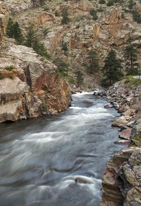
Cache la Poudre River
Colorado
The Cache la Poudre River is located east of the Continental Divide, in the northern Front Range of Colorado. It is affectionately known as the "Poudre" by local residents and long-time visitors to the area. The main and south forks of the Poudre originate in Rocky Mountain National Park, then flow north and east through the Roosevelt National Forest. The river eventually passes through the city of Fort Collins, then joins the South Platte River east of Greeley.
Historical accounts trace the name for the Cache la Poudre River to early French trappers who were caught in a snowstorm and buried their gunpowder in a cache near the mouth of the river. Most settlement of the area started in the 1870's and 1880's with mining and railroad building in northern Colorado. Trees were cut for railroad ties by "tie hackers" and then floated down the Poudre River. The attempted railroad up the Poudre Canyon was never completed, but many of the grades became the foundation for Highway 14. Early mining exploration had only marginal success as well, leaving ghost towns such as old Poudre City to tell the story.
Designated Reach
October 26, 1986. From Poudre Lake downstream to where the river intersects the easterly north-south line of the west 1/2 SW 1/4 of section 1, T8N, R71W of the sixth principal meridian. The South Fork from its source to section 1, T7N, R73W of the sixth principal meridian; from its intersection with the easterly section line of section 30, T8N, R72W of the sixth principal meridian to the confluence with the main stem.
Outstandingly Remarkable Values
Recreation
Visitors to the wild section of the Cache la Poudre find outstanding opportunities for solitude and primitive forms of recreation. Activities include hiking, backcountry camping, fishing, horseback riding, and occasional kayaking for the most adventurous paddlers. The Poudre River Trail extends along the entire length of the river within the park, providing non-motorized access to the remotest reaches of the wild and scenic river designation.
The Poudre River has attracted rafters and kayakers since the 1950's. Rapids on the river are classified from Class I to VI under the International Whitewater Rating System and vary greatly according to water levels. The rafting season generally occurs from May through August.
Scenery
The Cache la Poudre River carves its way through a wide, expansive valley in the northwestern portion of the park. Dense montane forests line the edge of wet meadows along the valley bottom, framed by stunning, high-elevation mountains and ridgetops of the Mummy Range. The river corridor features high cliffs and interesting rock formations along with vegetation including ponderosa and lodgepole pines, sage brush, mountain mahogany, and aspen. Seasonal variations, exceptional air quality, dark night skies, and wildlife viewing add to the exceptional scenic quality of the Cache la Poudre River landscape. From Trail Ridge Road, millions of visitors each year take in the unparalleled beauty of this wild river valley.

